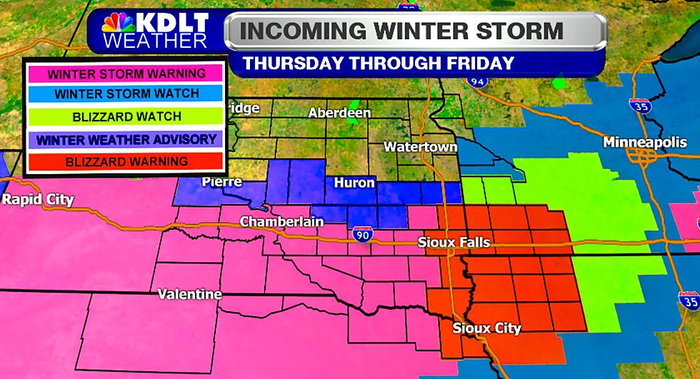
Blizzard Warning For Sioux Falls Area
*BLIZZARD WARNING FROM 6 PM THIS EVENING TO 6 PM FRIDAY*
The National Weather Service in Sioux Falls has issued a Blizzard Warning, which is in effect from 6 PM this evening to 6 PM CST Friday.
A possible mix of rain and snow this afternoon will change to all snow by early this evening. Snow will continue heavy at times Thursday night and Friday morning, before gradually tapering off Friday afternoon.
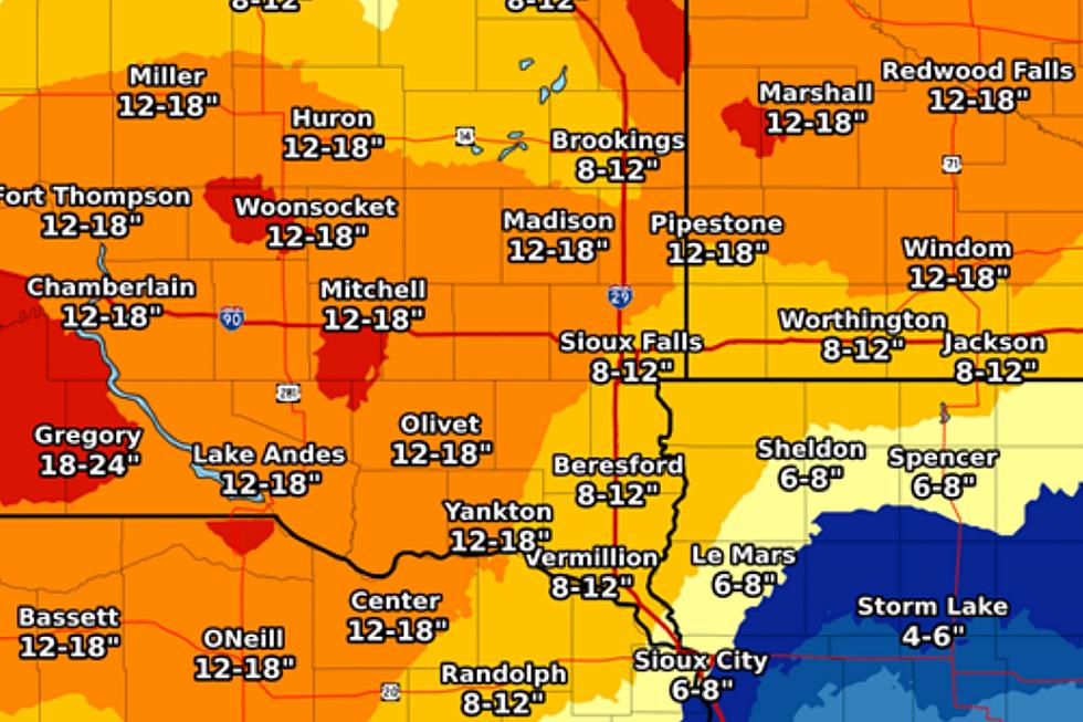
Storm total snow accumulations averaging 6 to 12 inches are likely, with the heaviest amounts expected south of Highway 18 in northwest Iowa and extreme southeast South Dakota.
Winds will increase from the north around 25 to 35 mph tonight and Friday, with gusts to near 40 mph at times. Visibility will be reduced to less than a quarter-mile at times, especially while snow is falling.
A Blizzard Warning means severe winter weather conditions are expected or occurring. Falling and blowing snow with strong winds and poor visibilities are likely. This will lead to whiteout
conditions making travel extremely dangerous. Do not travel. If you must travel...have a winter survival kit with you. If you get stranded stay with your vehicle.
See Also:
More From KKRC-FM / 97.3 KKRC